
Brooklyn-Queens Expressway South from 65th Place
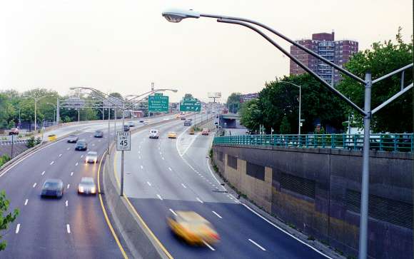 We're looking south from the Uber-Place, 65th Place at the southern edge of Woodside, Queens, as the Brooklyn bound BQE prepares to lift off into the air from the open cut depression it ran through from far off Astoria to the north.
 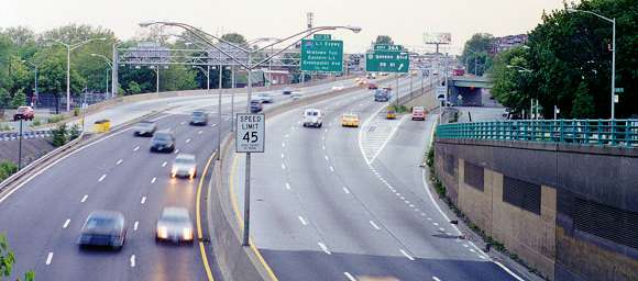 This part of the Brooklyn-Queens Expressway traces the original route from the late 1930s that basically served to connect Queens Boulevard with both the Queens-Midtown Tunnel and Kosciuszko Bridge, that back then ran into Meeker Avenue, which was destined to end up the shadowed service road for the Greenpoint stretch of the latter day post-war era BQE.
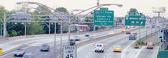 In the mid 1960s, this section of the Brooklyn-Queens was rebuilt from an antiquated West Side Highway era elevated into a modern Interstate-worthy arterial. Years later in our current century it underwent more renovation.
The exit to the right is for eastbound Queens Boulevard traffic.
Although Queens Boulevard was already passed a block prior there was no room for a cloverleaf type interchange, so motorists needing to go eastbound have to backtrack through side streets back to the boulevard.
Much of the area surrounding the elevated section of highway just beyond the bend is dominated by the New Calvary Cemetery.
In the mid 1960s, this section of the Brooklyn-Queens was rebuilt from an antiquated West Side Highway era elevated into a modern Interstate-worthy arterial. Years later in our current century it underwent more renovation.
The exit to the right is for eastbound Queens Boulevard traffic.
Although Queens Boulevard was already passed a block prior there was no room for a cloverleaf type interchange, so motorists needing to go eastbound have to backtrack through side streets back to the boulevard.
Much of the area surrounding the elevated section of highway just beyond the bend is dominated by the New Calvary Cemetery.These views hail from long ago June 1998.